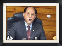
Nagaland's Konyak Union, a tribal body in the state, has complained to Chief Minister Neiphiu Rio over an error showing part of Mon district (in Nagaland) with Charaideo ditrict (Assam) on Google Maps. Instead, they claim that many areas categorised as being in Assam on the map are in fact supposed to fall under Mon district.
Previous History and Off Limits Areas of Nagaland
- Nagaland: Formed a state 1963 and by reorganisation from Assam as per the borders of British rule
- Konyak Union holds traditional understanding and historical agreement between Ahoms and the ‘Konyaks Nagas as an independent Nation.
- The dispute over the boundary is now before India's Supreme Court.
- The Konyak Union has warned of 'serious repercussions' if the mapping is not rectified with immediate effect, and appealed to Chief Minister Neiphiu Rio and concerned officials.
Facts About the Konyak Union
- Founded in 1979 to represent the Konyak tribe of Nagaland, India.
- NOTE:- The tribe has distinct facial tattoo marks, heritage of warriors right on their face followed by wood work which is finest in norther side and other skills like making bamboos, shifting cultivation etc,……the language belong to Tani sub-branch of Sino-Tibetan family.
- Cell supports rights of tribal people.
Month: Current Affairs - September 10, 2024
Category: