OVERVIEW
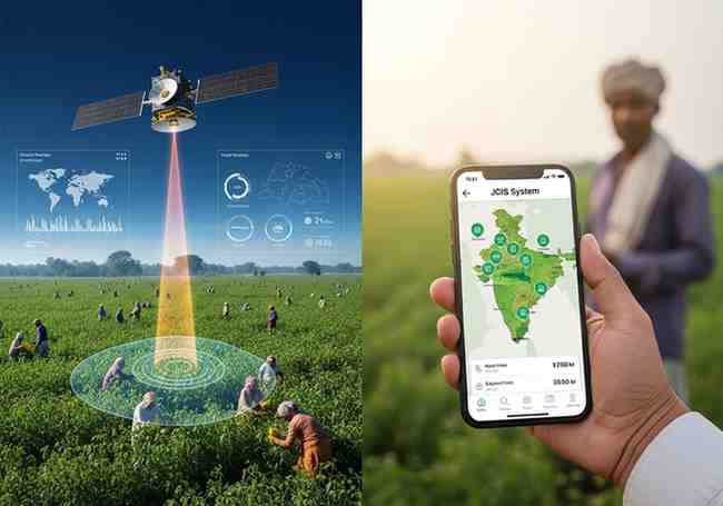
The National Jute Board is now using a smart system to track jute crops. It is called the Jute Crop Information System (JCIS). This system was launched in 2023. It was developed with help from ISRO (Indian Space Research Organisation) and the Jute Corporation of India. JCIS uses satellite images, weather data, and field reports to monitor jute farming. It has two tools: BHUVAN JUMP (a mobile app) and PATSAN (a web platform). The system gives early warnings about floods, dry spells, and crop stress. This helps farmers and officials make better decisions.
LATEST NEWS: JCIS IMPLEMENTATION STEPPED UP
The National Jute Board has recently increased the use of the Jute Crop Information System (JCIS) . This means more jute-growing areas are now covered under this technology-driven platform. The goal is to improve crop monitoring and production assessment in the jute sector.
WHAT IS THE JUTE CROP INFORMATION SYSTEM?
JCIS is a modern, technology-based platform. It was launched in 2023 . It was created in collaboration with:
The system brings together satellite imagery, weather analytics, vegetation indices, and field-level inputs. This allows near real-time monitoring of jute cultivation and production trends.
TWO DIGITAL TOOLS OF JCIS
The system has two main tools:
| Tool |
Type |
Purpose |
| BHUVAN JUMP |
Mobile application |
Field-level monitoring by ground staff |
| PATSAN |
Web-based analytics platform |
Surveillance and crop assessments for officials and stakeholders |
BHUVAN JUMP helps collect geo-tagged field data. PATSAN helps analyse that data on a larger scale.
FEATURES OF JCIS
The system offers many useful features:
-
Automated reporting – no need for manual papers
-
Near real-time crop estimation – know crop health quickly
-
Early warning alerts – for weather and crop stress conditions
I-CARE field network: The National Jute Board uses this network to collect large amounts of geo-tagged field data through the BHUVAN JUMP app.
Crop Cutting Experiments: The system uses geospatial smart-sampling techniques. This improves the accuracy of yield estimation and production modelling.
Flood impact assessment: JCIS has developed flood models using satellite data and field validation. These models estimate crop losses and quality damage in flooded areas.
Month: Current Affairs - May 13, 2026
Category: JuteCropInformationSystem